Smithsonian contributions to knowledge
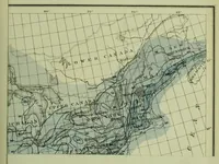
A Smithsonian Institution series volume from 1848, published in Washington, offering scientific papers to a general readership of researchers. Its one picture is a geographic chart of eastern North America, with grid lines of longitude, shaded regions, and labelled places such as Lower Canada, Upper Canada and New Brunswick, drawn in fine black line over pale blue wash. A designer might take its dense hairline contour and grid structure as a model for technical map linework and muted blue tints.