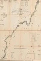
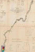
Das Land zwischen den Katarakten des Nil: mit einer Kt., astronomisch bestimmt und aufgenommen im Jahre 1827 ; [Tagebuch meiner Reisen]: Land zwischen den kleinen und großen Katarakten des Nil: mit Grundrissen der Monumente
A German travel record by Anton von Prokesch-Osten, surveyed and drawn in 1827, mapping the Nile between its cataracts in Egypt and Nubia for archaeologists and readers of travelogues. The two pictures are a long folded plan of the river with dotted sounding points, shoreline detail and small-scale ground plans of temples and monuments set around the margins, all in sepia linework with a few small legends and a colour key.