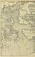
Nouus orbis regionum ac insularum ueteribus incognitarum,
A 1532 Basel compilation of voyage accounts and world geography by Johann Huttich and Simon Grynaeus, printed by Johann Hervagius for a scholarly readership of humanists and travellers. The woodcut map shows a galleon with billowing sails sailing across ocean lines beside coastlines, islands, and place names such as India, Taprobane, and Mare pacificum, offering a designer a compact model of early sixteenth-century cartography.