The map of Africa by treaty
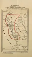
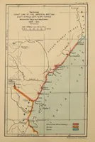
A treaty compendium published in London in 1909 by Harrison and Sons for His Majesty's Stationery Office, compiled by Edward Hertslet and later editors to record African boundaries set by agreements. The two pictures are plain colour-tinted cartographic maps, one showing the district of Tati with red-outlined boundaries and labelled territories, the other a coastline map of British East Africa with a bold red and orange route and inset labels. A designer could draw on their flat sheet layout, hand-lettered place names, and the sharp contrast of red boundary lines against pale ground.