Levels of Pennsylvania
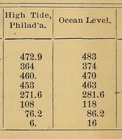
Levels of Pennsylvania is a printed tabular report compiled by Charles Allen and published in Harrisburg in 1876, most likely for state surveyors and officials. The single picture is a plain printed table on tan paper with two columns of numbers under the headings High Tide, Philad'a and Ocean Level. A designer might take from it a sparse, typeset data-table look, with ruled borders, centred numerals and aged paper tones suited to scientific or archival layouts.