Le conducteur français : contenant les routes desservies par les nouvelles messageries, diligences & autres voitures publiques : avec un détail historique & topographique des endroits par où elles passent & de ceux qu'on peut appercevoir, des notes curieuses sur les chaînes de montagnes que l'on traverse, relativement au système physique de Philippe Buache, premier géographe du roi : enrichi de cartes topographiques, dont les routes seront distinguées par une coleur : dressées & dessinées sur les lieux
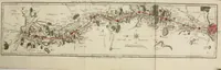
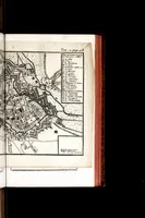
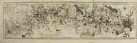
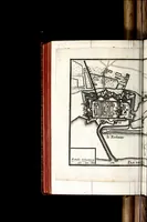
A 1776 Paris guidebook for travellers, compiled by Louis Denis with geographer Philippe Buache, listing the routes served by the royal stagecoach and post services and describing the towns and mountains along them. Its folding and page-sized maps show fortified town plans with star-shaped bastions, and long strip maps where the road network is traced in red over hand-drawn terrain. A designer might take the bastion plans as strong geometric motifs and the red routes as a clear, linear way to show journeys across a landscape.