Gabonais, Pahouins, Gallois
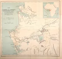
Gabonais, Pahouins, Gallois is a travel account by the marquis de Compiègne, published in Paris by Plon in 1878, describing Gabon and French-speaking equatorial Africa for a French reading public. The single picture is a folding route map of the Ogooué river and the Sam-Quita region, with a small inset locating it within Africa, drawn in fine hand-coloured lines with lettered place names and blue waterways that a designer could take as a model for cartographic linework and legend layout.