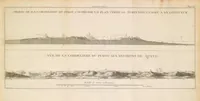
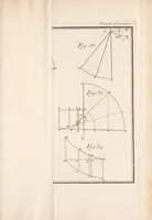
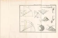
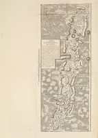
La figure de la terre, déterminée par les observations de messieurs Bouguer & de La Condamine, de l'Académie royale des sçiences, envoyés par ordre du roy au Pérou, pour observer aux environs de l'équateur : avec une relation abregée de ce voyage, qui contient la description du pays dans lequel les opérations ont été faites
Pierre Bouguer's 1749 Paris account of the French Academy expedition to Peru that measured the figure of the earth near the equator, with a travel narrative for scholars and geodesists. The pictures are engraved plates of triangulation diagrams, a map of the Quito region, and mountain profiles, showing precise linework a designer could borrow for technical diagrams, cartographic hatching, and topographic cross-sections.