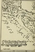
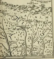
The discoveries of John Lederer, in three several marches from Vriginia, to the west of Carolina, and other parts of the continent: begun in March 1669, and ended in September 1670. Together with a general map of the whole territory which he traversed
John Lederer's 1672 London account of three exploring marches from Virginia westward into Carolina and beyond, printed by J. C. for S. Heyrick and translated with a general map for English readers interested in the continent's interior. The pictures are a finely engraved route map with dotted itinerary lines, hand-drawn town and mountain symbols, a compass rose with fleur-de-lis point, and a stone arcade drawing from a later reprint; a designer might take the map's dense cartouche lettering and tiny pictographic icons as a model for antique cartography.