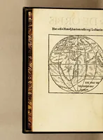
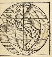
De orbis situ ac descriptione, ad reuerendiss. D. archiepiscopum Panormitanum, Francisci, monachi ordinis Fra[n]ciscani, epistola sane qua[m] luculenta. : In qua Ptolemæi, cæterorumq[ue] superioru[m] geographorum hallucinatio refellitur, aliaq[ue] præterea de recens inuentis terris, mari, insulis
A 1529 Latin geographical letter by the Franciscan monk Franciscus, printed in Antwerp by Martinus Caesar for the bookseller Rolandus Bollaert, addressed to the archbishop of Palermo and correcting Ptolemy on newly found lands. The pictures are small woodcut world maps on spherical projections, with Americas and Ptolemaic place names, plus a decorative initial and a printer's device with a motto and lions that a designer could borrow for period map motifs and heraldic emblems.