Inside Out Library · Explore
The Silurian system, founded on geological researches in the counties of Salop, Hereford, Radnor, Montgomery, Caermarthen, Brecon, Pembroke, Monmouth, Gloucester, Worcester, and Stafford : with descriptions of the coalfields and overlying formations
Murchison, Roderick Impey, Sir, 1792-1871, Murray, John, 1778-1843, publisher, Clive, Harriet Windsor, 1797-1869, illustrator, Ince, Joseph Murray, 1806-1859, illustrator, Murchison, Charlotte, 1788-1869, illustrator, Phillips, Mrs., active 1839, illustrator, Salter, John William, 1820-1869, illustrator, Stackhouse Acton, Frances, 1794-1881 or 1882, illustrator, Traherne, Charlotte Louisa, -1880, illustrator, Webster, Thomas, 1773-1844, illustrator, Whymper, Josiah Wood, 1813-1903, illustrator, Picken, Andrew, 1815-1845, lithographer, Scharf, George, 1788-1860, lithographer, Taylor, Richard, 1781-1858, printer, Taylor, John Edward, active 1840-1855, printer, Hullmandel, Charles Joseph, 1789-1850, printer of plates, Gardner, James, publisher and engraver, engraver, Day & Haghe, lithographer, J. Hatchard and Son, binder. DSI, Burndy Library, donor. DSI · 1839 · London : John Murray, Albemarle Street · 2 pictures
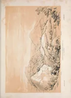
Sir Roderick Murchison's 1839 geological survey The Silurian System was published by John Murray in London and aimed at geologists and mining scholars. Its plates, drawn by Harriet Windsor Clive and Joseph Murray Ince, show rugged Welsh and Shropshire rock outcrops and a wooded gorge rendered in soft pencil-like tones, useful for designers wanting naturalistic landscape study.
Geology · Geology, Stratigraphic
Internet Archive · Smithsonian Libraries · Public domain (published before 1931) · More from this library