Inside Out Library · Explore
The Silurian system, founded on geological researches in the counties of Salop, Hereford, Radnor, Montgomery, Caermarthen, Brecon, Pembroke, Monmouth, Gloucester, Worcester, and Stafford : with descriptions of the coalfields and overlying formations
Murchison, Roderick Impey, Sir, 1792-1871, Murray, John, 1778-1843, publisher, Clive, Harriet Windsor, 1797-1869, illustrator, Ince, Joseph Murray, 1806-1859, illustrator, Murchison, Charlotte, 1788-1869, illustrator, Phillips, Mrs., active 1839, illustrator, Salter, John William, 1820-1869, illustrator, Stackhouse Acton, Frances, 1794-1881 or 1882, illustrator, Traherne, Charlotte Louisa, -1880, illustrator, Webster, Thomas, 1773-1844, illustrator, Whymper, Josiah Wood, 1813-1903, illustrator, Picken, Andrew, 1815-1845, lithographer, Scharf, George, 1788-1860, lithographer, Taylor, Richard, 1781-1858, printer, Taylor, John Edward, active 1840-1855, printer, Hullmandel, Charles Joseph, 1789-1850, printer of plates, Gardner, James, publisher and engraver, engraver, Day & Haghe, lithographer, J. Hatchard and Son, binder. DSI, Burndy Library, donor. DSI · 1839 · London : John Murray, Albemarle Street · 3 pictures
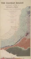
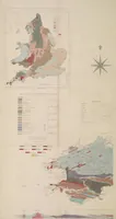
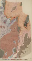
A geological treatise by Roderick Murchison, published in London by John Murray in 1839, presenting his survey of the Silurian rock system across the English and Welsh border counties. Its plates were drawn by Harriet Windsor Clive and Joseph Murray Ince and show the regional geology in coloured maps and sections. A designer could draw on the flat, layered palette of these hand-coloured maps, with their bands of pink, green, blue and ochre marking rock formations.
Geology · Geology, Stratigraphic
Internet Archive · Smithsonian Libraries · Public domain (published before 1931) · More from this library